Economic Growth & Development
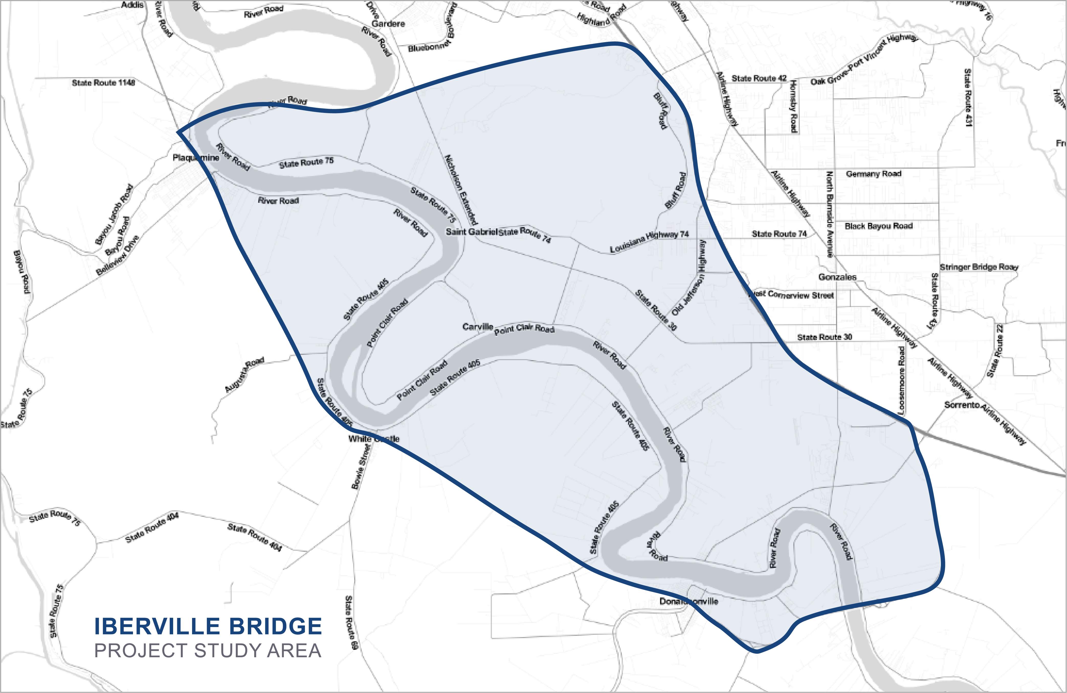
The project study area is located in southeast Louisiana on the west bank of the Mississippi River opposite East Baton Rouge and Ascension Parishes and on the east bank at Plaquemine Point near Sunshine and in St. James Parish from the Sunshine Bridge to I-10. The project area along LA 1 has a generally rural character with suburban aspects within the communities of Port Allen, Brusly, Addis, Plaquemine, White Castle and Donaldsonville. Outside of these cities and towns, farms and general agriculture are the predominant developed land use. Petrochemical and industrial sites are located along the Mississippi River in order to take advantage of the domestic and international maritime corridor.
Bordering the project area to the west is the Atchafalaya River Basin, the largest wetland area in the United States. It contains sprawling swamps and marshes interlaced with many bayous and canals. It offers freshwater fishing, hunting, bird watching and other outdoor recreational activities.
From pre-historic times into the historic period, Native American tribes occupied the area, including the Houmas, Mugulasha, Chitimacha and Bayougoula, taking advantage of the verdant land and its abundant game and fisheries.
The rise of the petrochemical industry in the area began in the early 1900’s with the development of oil refineries and support services. The Mississippi River allows these industries to provide goods and services throughout the world via the ocean-going and barge shipping modes.
Between Iberville and Ascension Parishes, there are more than 30 industrial sites straddling both sides of the Mississippi River and employing more than 30,000 Louisiana citizens.
A Problem for Commuters
Due to the lack of an efficient transportation system, residents who may desire to live on one bank but work on the opposite must consider the uncertain traffic conditions which may result on the I-10 Bridge. Not only might normal access be problematic, but conditions can worsen substantially if there are further problems, such as accidents or special events which may increase I-10 traffic beyond the normal congested condition. The traffic situation could be the deciding factor as to where residents and businesses choose to locate.
Table 1.2: Parish Populations
Table 1.2 provides population information for the corresponding years cited in Table 1.1. While there are many factors which determine population growth over time, these figures clearly show that communities on the west bank of the river are not experiencing the types of growth being experienced on the east bank. Certainly, one of these factors is the inefficient access provided by the current transportation system. Inefficient transportation access is also a factor in determining site suitability for industrial development. The availability of qualified employees may be limited if commuting options are lengthy or few. Also, getting raw materials into sites or finished products out and site services access are other factors which can determine the quality of suitable sites for development.
Despite these apparent barriers, industrial site suitability is high in Iberville Parish, and several established companies (Dow Chemical, Shintech, Syngenta, SNF Flowpam and Axiall, among others) have flourished there. (Source: : United States Census Bureau)

